Liberty St Cycle Track will change how people get around Harrisonburg.
Liberty Street connects the Bluestone Trail to the Northend Greenway
The proposed project would carry Harrisonburg’s north-south greenway corridor through downtown.
The City of Harrisonburg is asking for public feedback on the Liberty Street Project, also known as the Downtown Harrisonburg Streetscape & Mobility Transformation Project. The survey is open through June 2.
We support this project because it improves more than one street. Liberty Street would become the downtown link between the Bluestone Trail to the south and the Northend Greenway to the north.
Project master plan map: Liberty Street improvements from Noll Drive/Kratzer Avenue to Grattan Street, plus the shared-use path connection toward Martin Luther King Jr. Way and the Bluestone Trail.
Open larger mapThe City’s project materials describe the Liberty Street cycle track and shared-use path as a critical connection between the Bluestone Trail/JMU area and the proposed Northend Greenway extension. Together, these projects would create an approximately six-mile separated bicycle and pedestrian corridor through Harrisonburg.
Why Liberty Street matters
Liberty Street is one of downtown’s main corridors. The current street design does not provide a comfortable north-south route for people walking, biking, rolling, or taking transit through downtown. The proposed project would make the street safer and more useful while completing a gap in the city’s trail and greenway network.
The downtown greenway link
Liberty Street would connect the Bluestone Trail and the Northend Greenway instead of leaving them as separate pieces.
A protected bike route
The project converts one vehicle lane into a two-way separated bicycle facility, protected from traffic by a median.
Safer crossings
The design includes curb extensions, ADA-compliant curb ramps, enhanced crosswalks, pedestrian signals, and intersection improvements.
More access to downtown
Safer walking, biking, rolling, and transit access gives more people practical ways to reach downtown businesses and public spaces.
The transportation elements of this project are funded by a $14.3 million federal RAISE grant.
City materials also show that vehicle queues are expected to remain within acceptable limits, with no significant changes to travel time through the corridor.
Downtown businesses need people, not car storage
In “Cars aren’t customers”, Brent Finnegan argues that downtown access should be measured by how well people can reach businesses, not just by how many car parking spaces sit nearby. He points out that many bicycles can fit in the space used by one parked car, and that customers arrive in different ways.
A better Liberty Street would give more people more ways to reach downtown. It would make short trips more practical by bike, on foot, by mobility device, and by transit, while still preserving vehicle access through the corridor.
Finnegan also highlights a familiar Harrisonburg problem: many bike trips are possible on paper, but uncomfortable in practice because the network is disconnected. Liberty Street addresses that problem by creating a protected downtown connection where the current network has a gap.
What the street could look like
The project renderings show protected space for biking and rolling, improved pedestrian areas, new landscaping, and a more organized downtown corridor.
Perspective renderings: existing conditions and proposed improvements at Liberty Street and West Elizabeth Street, and Liberty Street and Warren Street.
Open larger renderingsPrivate investment along the corridor
The Liberty Street project would also shape how people experience nearby downtown redevelopment. The rendering below shows the proposed Link development at the former Lindsay Funeral Home site. It is included here to show how private investment along the corridor could relate to the public street project.
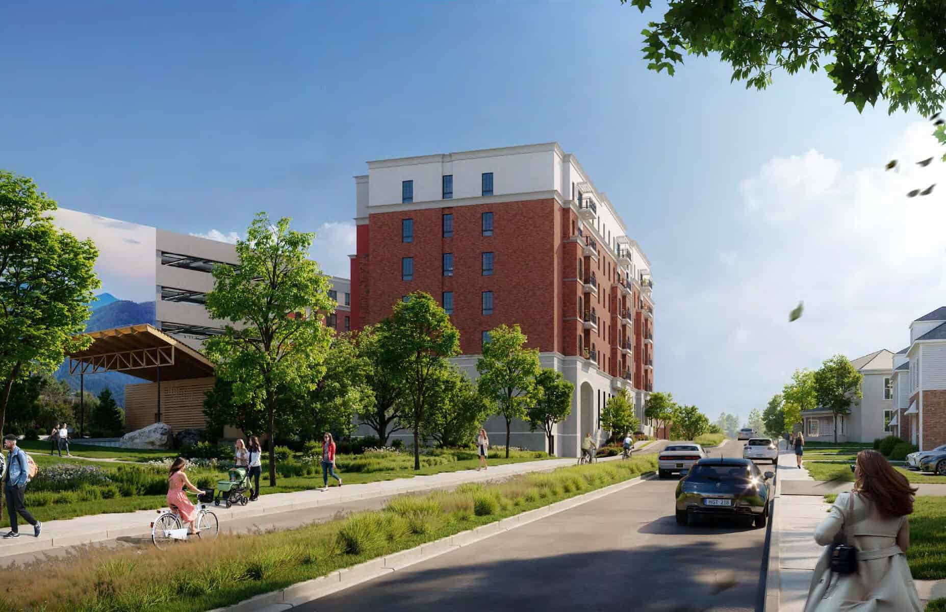
Rendering of the proposed Link development at the former Lindsay Funeral Home site. This image is from the private development proposal and is not a City of Harrisonburg rendering for the Liberty Street Project.
Open larger Link renderingTraffic impacts
The City studied vehicle queueing during peak travel periods. The traffic board states that vehicle queues are expected to remain within acceptable limits and that there will not be significant changes to travel time throughout the corridor.
Traffic impacts board: comparison of existing and proposed peak travel queue lengths at signalized intersections.
Open larger traffic boardHow to take the survey
After reviewing the project information, we encourage supporters to be clear.
- Q1: Review the project materials, then answer Yes.
- Q2: Select Strongly support.
- Q3: Answer honestly. If you reviewed the exhibits online, select Yes.
- Q4: If you support the design and do not have specific concerns, select No.
- Q5: Use the comment box to explain why this project matters to you.
Suggested comment
Review the project materials
These are the public hearing materials. Please review them before taking the survey.