Harrisonburg has been working on bike and pedestrian planning for a long time. This effort is part of how Harrisonburg learned to plan for people walking and biking.
Longer than many of us probably realize.
At a recent Harrisonburg Bike/Ped Subcommittee meeting, city staff walked through the history of Harrisonburg’s bike and pedestrian plans, dating back to the 1990s. What stood out wasn’t just how many plans there have been. It was how much the conversation has changed.
At first, the work was mostly about identifying bike routes.
Then it became about sidewalks.
Then greenways.
Then bike lanes, shared-use paths, school connections, comfort maps, crossings, and eventually the bigger question we are still working on today:
Can people actually get where they need to go safely and comfortably without a car?
That question used to feel ambitious. Or as City Staff and elected officials put it in the 1990s, “unreasonable.”
Now it feels like the baseline (at least from a planning perspective).
Understanding the evolution of these plans is crucial to grasping how Harrisonburg learned to plan for people walking and biking effectively.
It Started With Routes
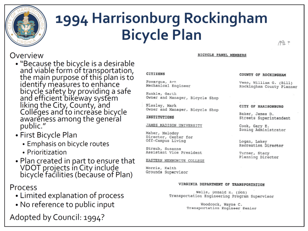
The first major plan discussed was the 1994 Harrisonburg-Rockingham Bicycle Plan.
That plan was regional. It included the City, Rockingham County, VDOT, JMU, and Eastern Mennonite College. It made the case that this area already had many of the ingredients for bicycling: a mild climate, rural roads, beautiful views, and a lot of bike travel connected to JMU and EMU.
It also had a practical purpose. At the time, VDOT needed a bicycle plan in place before funding or building bike facilities on roads.
So the plan helped get bicycling into the official transportation conversation.
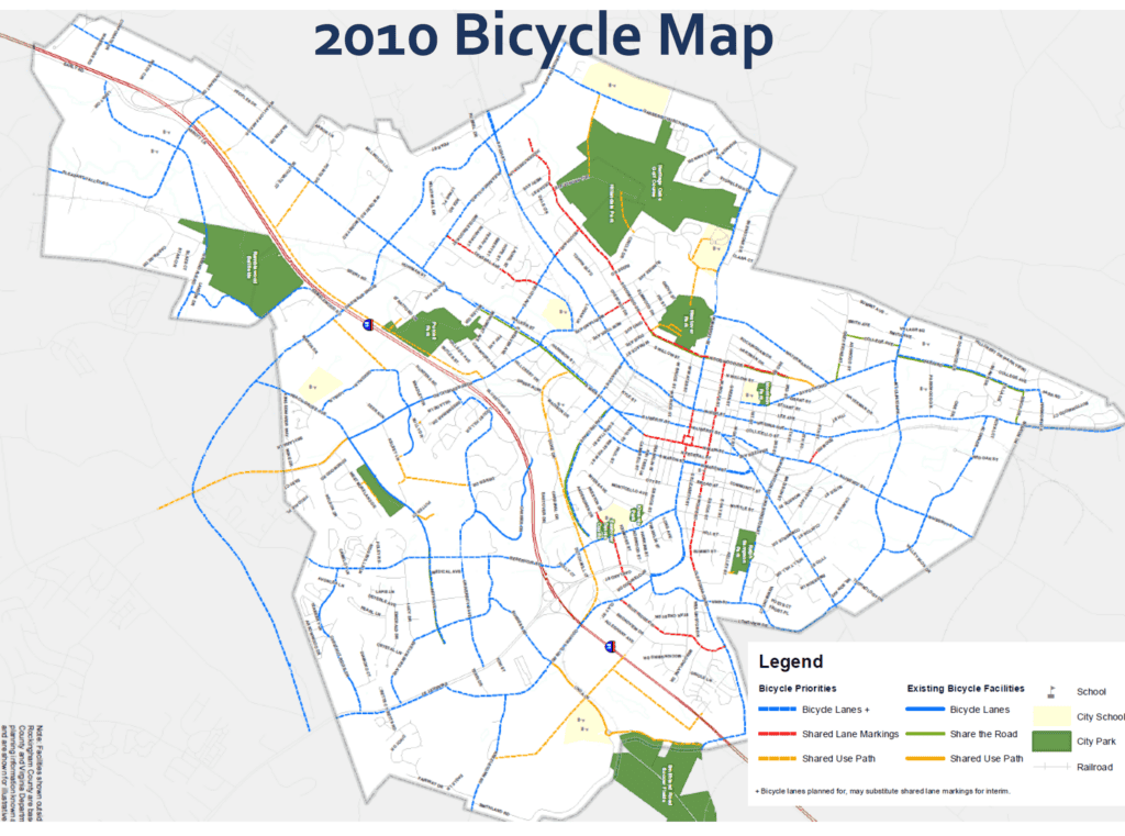
By 2000, the City had narrowed the focus. The plan became more city-specific and more streamlined. One phrase from that era still feels important:
A viable Bicycle Transportation Network.
That was the goal.
Not just a few good streets. Not just a few confident and fearless cyclists taking the lane.
A network.

Sidewalks Became Part of the Story
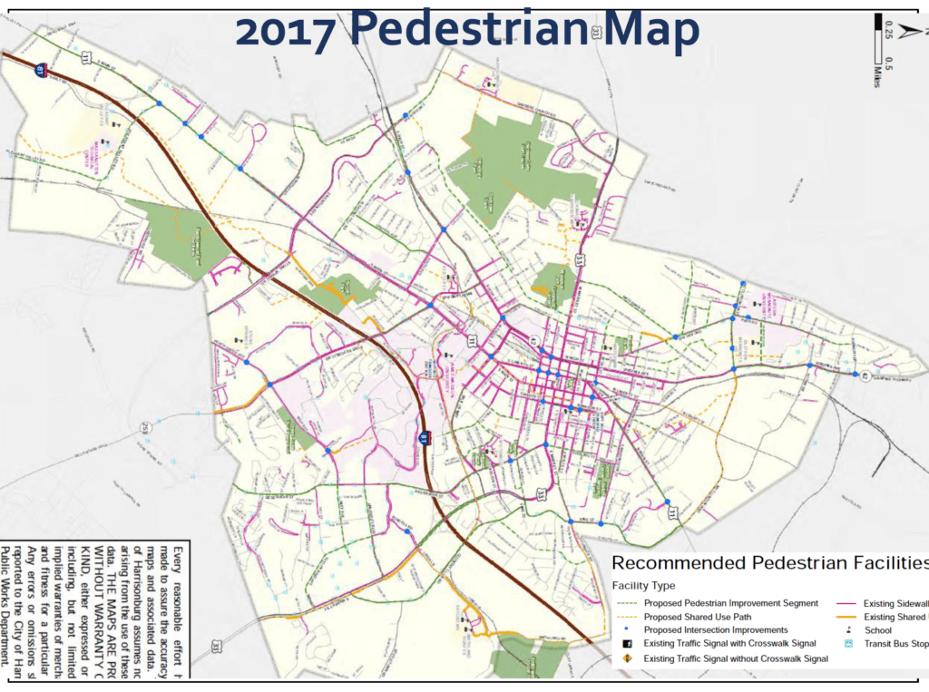
By 2005, Harrisonburg had a pedestrian plan, too.
That matters because bike/ped planning is not just about bicycles. It is about whether people can safely walk to school, get to a bus stop, reach a park, cross a busy street, or move through their neighborhood without being forced into a car for every trip.
The 2005 pedestrian plan identified sidewalk gaps and priority areas across the city.
Around this same period, Harrisonburg was also shifting expectations for new development. Sidewalks were becoming a basic part of what streets should include again.
That might sound obvious now.
But for many years, we built places where sidewalks were missing, disconnected, or treated as optional.
We are still living with those gaps today.
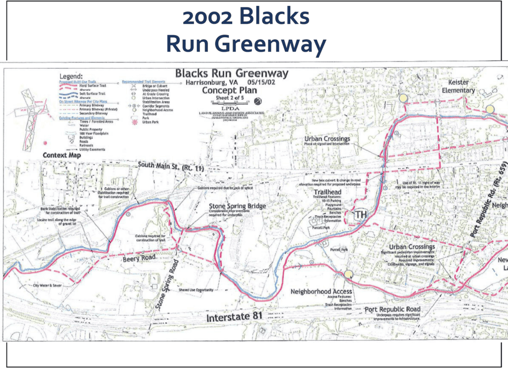
Greenways Changed the Imagination
The Blacks Run Greenway Master Plan added another layer.
It was not just a transportation plan. It was a vision for connecting people, neighborhoods, parks, water, and public space. All along Blacks Run with offshoorts.
That greenway thinking helped people imagine Harrisonburg differently.
A path was not just recreation. A trail could be transportation.
A creek corridor could become a way to connect communities.
Over time, that way of thinking helped shape projects like the Bluestone Trail, the Northend Greenway, and the Friendly City Trail.
The Bicycle and Pedestrian Subcommittee Matters
One of the most important parts of this history is not a map.
It is the people.
The Bike/Ped Subcommittee did not appear out of nowhere. Community members pushed for a more formal venue to discuss walking and biking. What eventually formed was a subcommittee under the Transportation Safety Advisory Commission.
That structure matters because it gave advocates, staff, and community members a place to keep showing up.
And showing up has been a huge part of this story.
Citizen advocates helped push plans forward, ask better questions, organize events, apply for grants, and keep walking and biking on the City’s agenda.
There was a time when this work had very little staff capacity behind it. There was a time when the idea that someone should be able to bike safely from one part of the city to another sounded unreasonable to some people.
That has changed. But only because people have pushed.
Davis Helped People See What Was Possible
In 2010, a group from Harrisonburg traveled to Davis, California, to study bike infrastructure.
That trip has come up again and again as an important moment in local bike/ped history.
It brought together city leaders, staff, advocates, and community members. It helped people see what a city could look like when bicycling was treated as normal transportation rather than an afterthought.
Did one trip transform Harrisonburg overnight?
Of course not.
But it helped stretch the imagination.
And sometimes that is what has to happen before anything gets built.
The Big Shift: From Lines on a Map to Comfort
Earlier plans were often about routes.
Later plans got more specific about facilities: bike lanes, sharrows, shared-use paths, sidewalks, and crossings.
But eventually Harrisonburg learned another lesson:
Just because a bike facility exists does not mean it feels safe.
A bike lane on a busy, fast, stressful street may technically count as infrastructure.
But does it work for a child?
Does it work for a new rider?
Does it work for someone trying to get to school, work, the grocery store, or a bus stop?
That is where the conversation started to change.
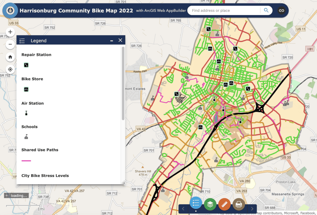
The City’s comfort map reflects that shift. It recognizes that hills, traffic speed, crossings, gaps, and stress all matter.
The goal is not just to say, “There is a bike lane there.”
The goal is to build places people will actually use.
How Harrisonburg Learned to Plan for People Walking and Biking
We Have Come a Long Way — And There Is More To Do
Harrisonburg has seen significant growth over the past two decades.
Sidewalks near schools. The Bluestone Trail.
The Friendly City Trail. The Northend Greenway.
Federal Street.
Safer crossings. Road reconfigurations.
More serious project planning.
More staff capacity. More data.
More public expectation that walking and biking belong in the transportation conversation.
But the work is not finished. There are still sidewalk gaps.
Still difficult crossings. Still, neighborhoods without comfortable connections.
Still places where biking or walking is technically possible, but not welcoming.
Still a need to connect bike/ped planning with transit, housing, development, schools, and downtown growth.
That is the next chapter.
The Real Lesson
The history of bike and pedestrian planning in Harrisonburg is not just a history of plans.
It is a history of people pushing the City to think differently.
From bike routes to greenways.
From sidewalks to shared-use paths.
From “experienced riders can make it work” to “would we invite a child to use this?”
From scattered improvements to the beginnings of a real network.
That change took decades.
It took advocates, staff, elected officials, planners, school partners, public health partners, and neighbors who kept showing up.
And that is probably the most important lesson for where we go next.
Plans matter.
But people make the plans happen and keep pushing for better and safer connections.

The shift from calling car-free travel “unreasonable” in the 90s to now considering it a baseline really captures how far planning has come. Living here, it’s easy to take the recent sidewalks and shared-use paths for granted, but