HARRISONBURG COMMUNITY BIKE MAP
The Harrisonburg Community Bike Map is a resource to help bicyclists choose routes along city streets and separated paths to get them to school, work, and around the City. Getting places by bike is a different experience than getting there by car; the best route for driving might not be the best route to bike.
When selecting a bike route, things to consider might include:
- How much traffic is on a street? Quieter streets make for a more pleasant ride.
- How wide is the street? Wider streets leave plenty of room for bicyclists on the sides.
- How many hills are along the route? Hills can be fun going down, but take some extra effort getting back up.
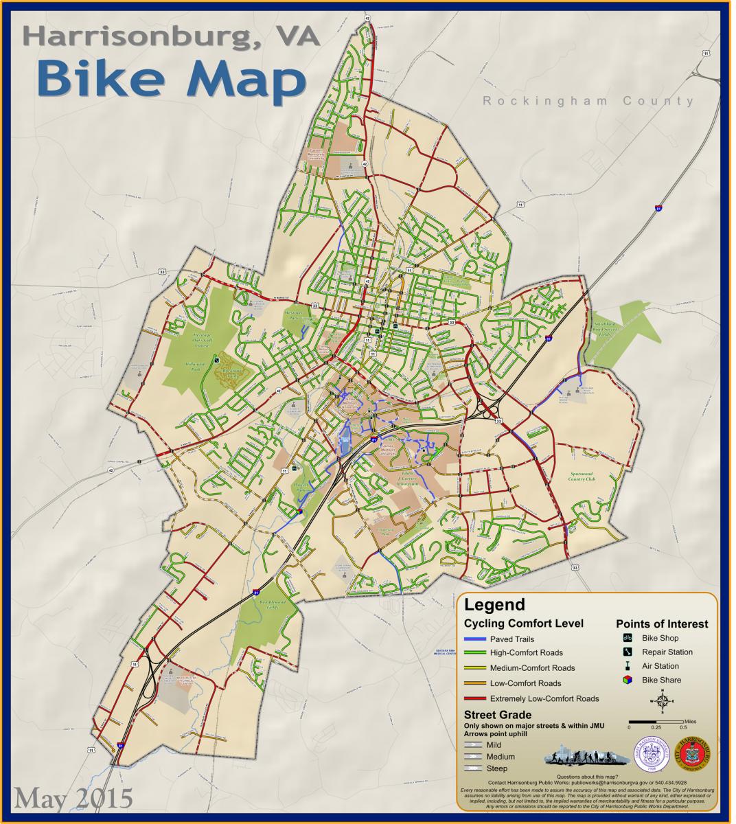
The Harrisonburg Community Bike Map classifies streets by cycling comfort based on the amount of stress a bicyclist is likely to encounter given a set of characteristics, such as the number of travel lanes, vehicle speeds, presence of a right turn lane, presence of bike lanes, and the type intersection traffic control. The “cycling comfort level” designation used was determined using a methodology developed by the Mineta Transportation Institute in its paper, Low Stress Bicycling and Network Connectivity
. For a summary of Harrisonburg’s methodology see ![]() [561KB] Bike Map Review Guide.
[561KB] Bike Map Review Guide.
The Harrisonburg Community Bike Map Project was developed by the City of Harrisonburg in partnership with James Madison University, and with technical and advisory support from Shenandoah Valley Bicycle Coalition, Harrisonburg-Rockingham Metropolitan Planning Organization, and the Central Shenandoah Planning District Commission.
Questions? Contact Brad Reed, Transportation Planner, at
or 540-434-5928.